


As Hurricane Fausto churns in Pacitic, tropics quiet in the Atlantic
As Hurricane Fausto churns in Pacitic, tropics quiet in the Atlantic

Jennifer Sangalang, USA TODAY NETWORK - FloridaSun, July 26, 2026 at 1:38 PM UTC
0
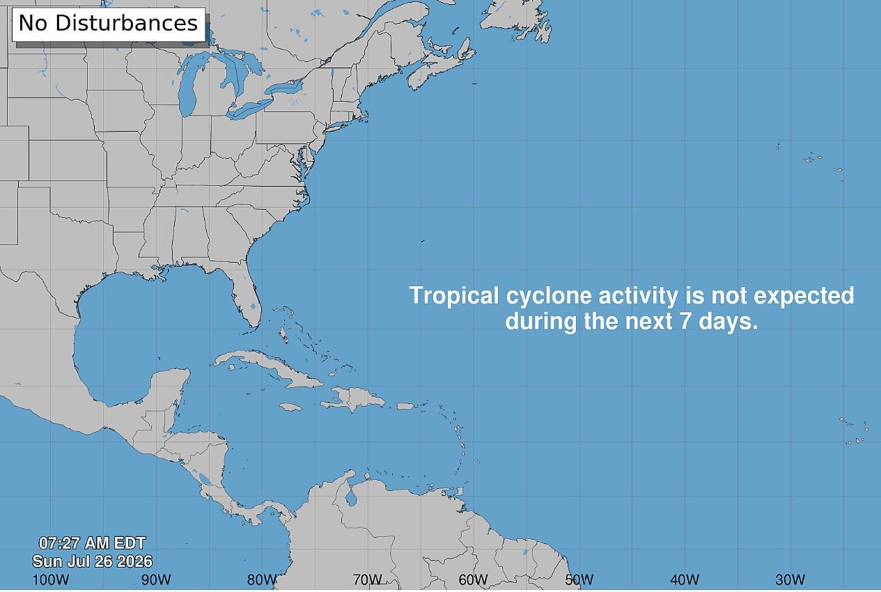
Bertha has fizzled and almost two months after the start of hurricane season, the tropics are quiet − for the Atlantic. There are two active systems churning in the Pacific, however.
According to the Sunday, July 26, 2026, weather advisory from the National Hurricane Center in Miami, Florida, tropical cyclone formation for the North Atlantic, Caribbean Sea and the Gulf of America (previously known as the Gulf of Mexico) was not expected during the next 7 days.
The National Hurricane Center did issue advisories on Hurricane Fausto, east of Hawaii, and Hurricane Genevieve, southwest of Mexico (see below).
Arthur, the first named storm of the hurricane season, briefly strengthened into tropical storm status June 17, 2026, before the hurricane center downgraded it to a disturbance not long after. Tropical Storm Bertha formed more than a month later − July 20, 2026, made its second landfall three days later near the Texas-Louisiana border, and quickly weakened.
➤ Track all active storms
Shop Home Depot for hurricane prep
There have been no other named storms so far into the second month of the 2026 Atlantic hurricane season.
In 2025, no storms made landfall in the U.S. during hurricane season, but it was an active one.
The hurricane center graphics and live weather radars below show what's swirling in the tropics (if anything) as well as the conditions for potential rain, flash flood and other warnings.
Atlantic hurricane season is from June 1 to Nov. 30 every year, with the most activity between August and October. Should a weather system develop into a tropical storm, the third system would be named Cristobal, shown on the list of the 2026 Atlantic hurricane season names below.
The hurricane center resumed its tropics advisories ahead of hurricane season − on May 15.
➤ Weather alerts via text: Sign up to get updates about current storms and weather events by location
Keep reading for information about tropical storm activity for Sunday, July 26, 2026.
National Hurricane Center in Miami, Florida, forecast on tropical activity: Is there a tropical storm or hurricane now?
According to the Sunday, July 26, 2026, tropical outlook from the National Hurricane Center in Miami, Florida, there is no tropical cyclone activity expected during the next 7 days. The graphic above automatically updates with the most recent location for any or all disturbances.
The Atlantic basin consists of the northern Atlantic, Caribbean Sea and Gulf of America. NOAA changed its naming convention for the Gulf of Mexico after the U.S. Geological Survey changed the name on U.S. maps per President Trump's order.
Advertisement
In addition, the National Hurricane Center was tracking four tropical waves on Sunday, July 26, 2026:
A tropical wave has emerged off Africa and now has an axis along 19W from 10N to 17N, moving W at 15 to 20 knots. Scattered moderate convection was noticed from 12N to 15N E of 20W.
A central Atlantic tropical wave has an axis along 47W, from 08N to 22W, moving W at around 15 knots. Scattered moderate convection was noted E of this wave from 08N to 12N between 37W and 47W.
An eastern Caribbean tropical wave has an axis along 64W, from the Virgin Islands into Venezuela, moving W at around 15 knots. Scattered moderate to isolated strong convection was behind this wave from 12N to 19N between 54W and 64W, and was impacting much of the waters near the Lesser Antilles.
A central Caribbean tropical wave has an axis along 74W, moving W at around 15 knots. No convection was associated with this wave.
Where is Hurricane Fausto?
On Sunday, July 26, the National Hurricane Center issued advisories on Hurricane Fausto, which it said was "crossing into the Central Pacific but still located well east of the Hawaiian Islands."
Well Southwest of Hawaii (CP92), according to the NHC:
Showers and thunderstorms associated with a broad area of low pressure located well west-southwest of the Hawaiian Islands continue to gradually become better organized. Environmental conditions appear conducive for additional development of this system while it moves generally westward at 10-15 mph. A tropical depression was expected to form over the next day or so as the system crosses the International Date Line, entering the western Pacific basin.
Formation chance through 48 hours was high at 90 percent.
Formation chance through 7 days was high at 90 percent.
Where is Hurricane Genevieve?
On Sunday, July 26, the National Hurricane Center issued advisories on Hurricane Genevieve, "located well southwest of the southwestern coast of Mexico."
From the NHC:
At 2 a.m. Sunday, the center of Hurricane Genevieve was moving toward the west-northwest near 17 mph. A west-northwestward to northwestward motion with some decrease in forward speed is expected during the next few days.
Satellite images indicate that maximum sustained winds have increased to near 90 mph with higher gusts. Continued rapid intensification is expected during the next day or so, and Genevieve was forecast to become a major hurricane by late today.
Recent satellite-derived wind data indicate that hurricane-force winds extend outward up to 40 miles from the center and tropical-storm-force winds extend outward up to 195 miles.
The USA TODAY Network in Florida will produce daily tropics watch advisories.
2026 Atlantic hurricane season predictions
2026 hurricane season names: This Florida city has déjà vu as Sally returns on the list
Is it raining in Florida today? Live weather radar
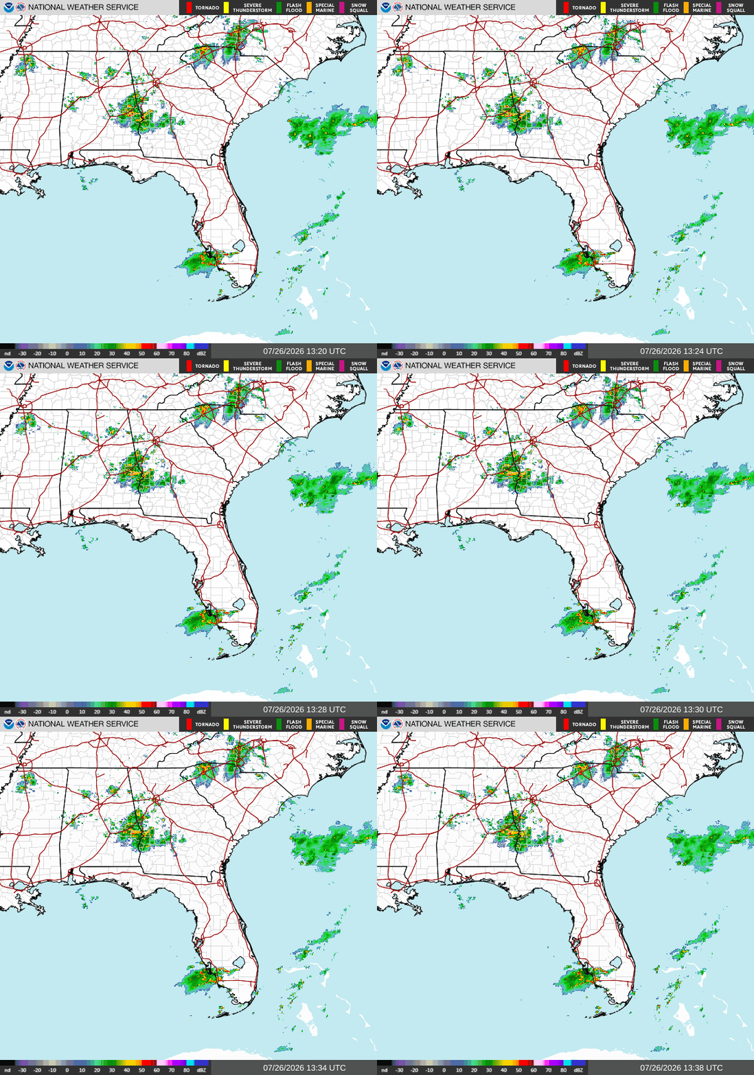
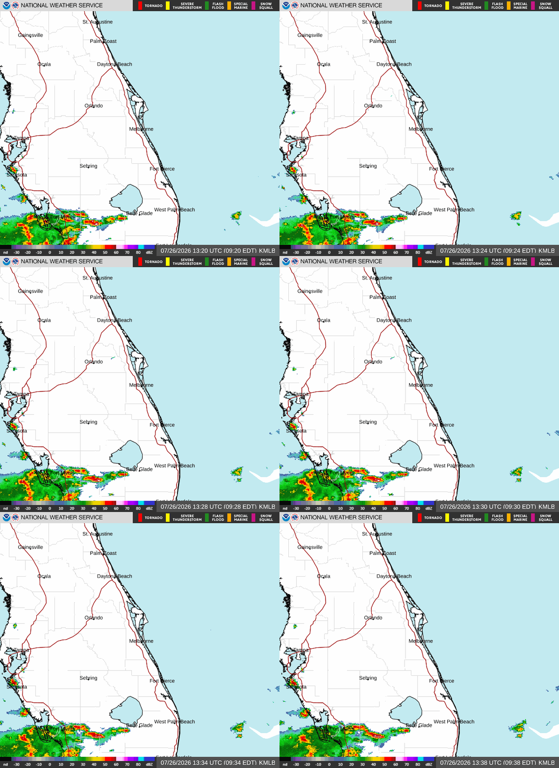
Shown is the National Weather Service radar, which shows conditions in real-time for the Southeast United States and parts of Central Florida. The current date and time show up on the bottom right of this radar embed; otherwise, you may need to clear your cache.
Weather watches and warnings issued in FloridaWhat are the 2026 Atlantic hurricane season names? Did your name make the hurricane season names list?
Since 1953, the National Hurricane Center has released a list of names in alphabetical order for Atlantic tropical storms before each season begins, which it recycles every six years. It retires names of storms that are excessively deadly or costly, if it would be insensitive or inappropriate to use them again. These are the 2026 Atlantic tropical cyclone names:
Arthur, which formed as a tropical storm June 17, 2026
Bertha, which formed as a tropical storm July 20, 2026
Cristobal
Dolly
Edouard
Fay
Gonzalo
Hanna
Isaias
Josephine
Kyle
Leah
Marco
Nana
Omar
Paulette
Rene
Sally
Teddy
Vicky
Wilfred
Interactive map: Hurricanes, tropical storms that have passed near your cityStay informed. Get weather alerts via textWhat's next?
We will provided tropical weather coverage daily until Nov. 30 to keep you informed and prepared. Download your local site's app to ensure you're always connected to the news. And look for our special subscription offers here.
Contributing: Cheryl McCloud and Olivia Franklin, USA TODAY Network-Florida
This article originally appeared on Tallahassee Democrat: As Hurricane Fausto churns in Pacitic, tropics quiet in the Atlantic
Source: “AOL Breaking”
